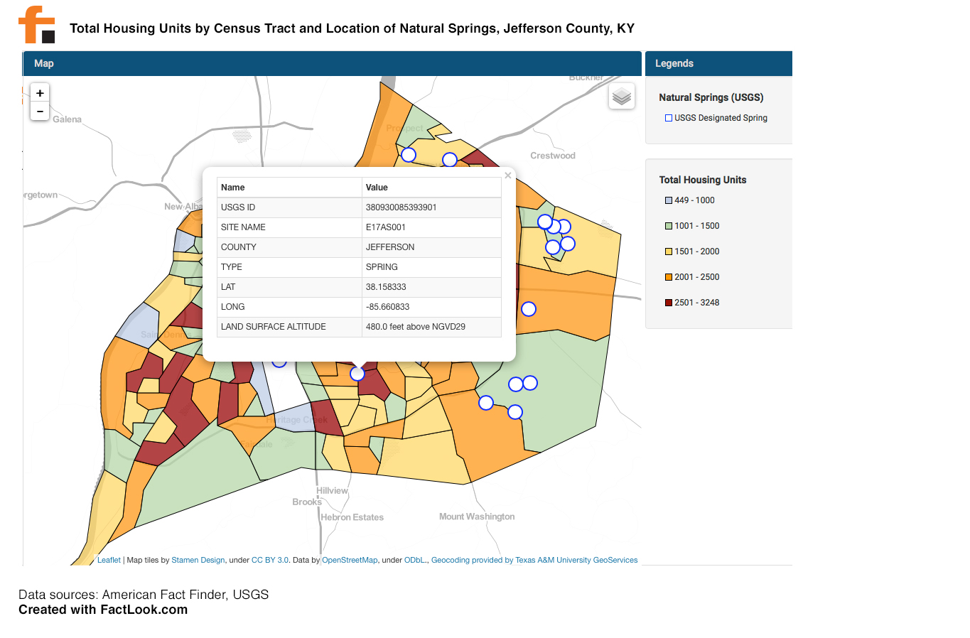
We used FactLook to create this visualization that displays two datasets: the Total Housing Units by Census Tract; and the location of natural springs in Jefferson County, Kentucky.
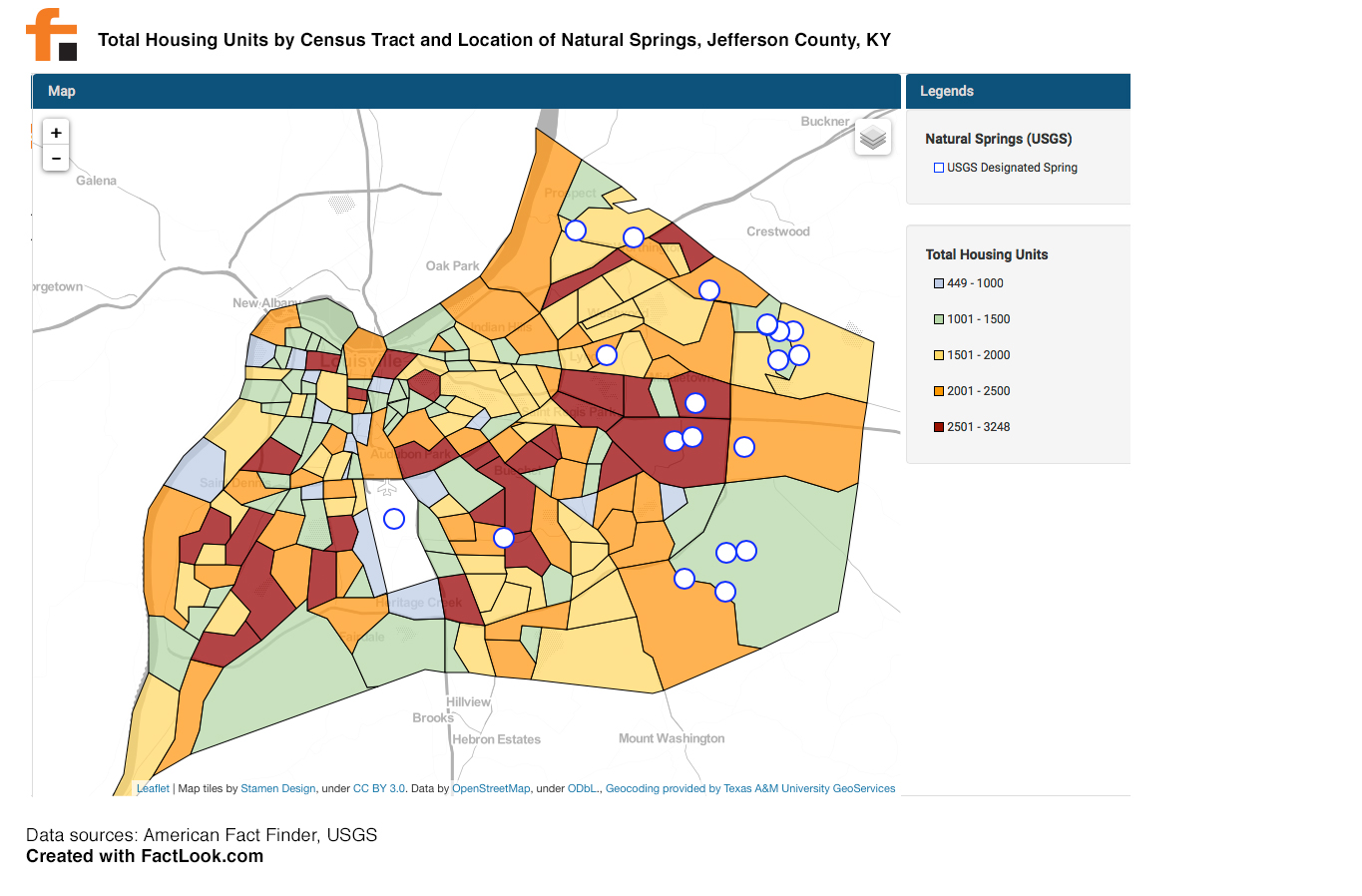
Using data from the US Census Bureau’s American FactFinder, we created a layer displaying the total housing units by census tract. We then used the latitude and longitude coordinates from the USGS data to place makers at the locations of natural springs. Clicking on a marker within FactLook reveals data provided imported from the USGS data.