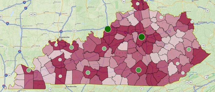
This map was created to show the unemployment rate by county in Kentucky with geocoded locations of several community colleges displaying enrollment rates. Map was used to display correlation between unemployment and location of affordable schools.
This map was created to show the unemployment rate by county in Kentucky with geocoded locations of several community colleges displaying enrollment rates. Map was used to display correlation between unemployment and location of affordable schools.