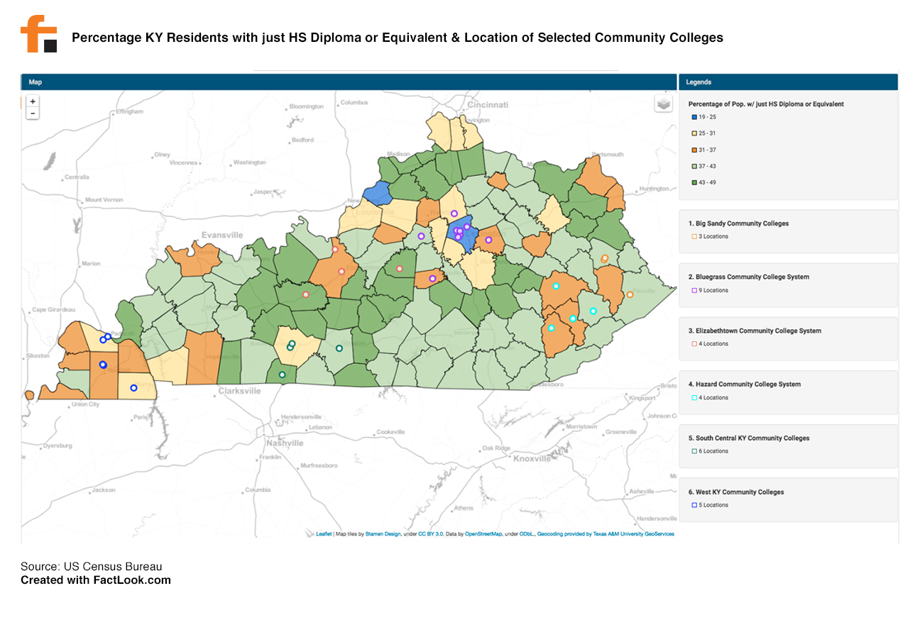
FactLook was asked by a client in the higher education field to create a data visualization displaying the geographic distribution of individuals in Kentucky possessing a high school diploma or the equivalent. We mapped those values by county using data found through the US Census Bureau’s American FactFinder. We then plotted the location of several community college campuses using each college’s latitude/longitude coordinates.
Here is the result.