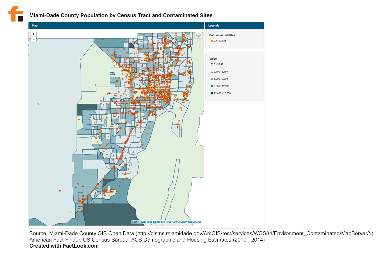
The Miami-Dade County OpenData portal has a dataset on contaminated sites — nearly 2,500 of them — across the county. We used FactLook’s latitude and longitude geocoding feature to plot those sites. We then pulled population data for Miami-Dade from the US Census Bureau. The resulting data viz is below.
Want to build a data viz like this one?
Take FactLook for a 7-day FREE trial.