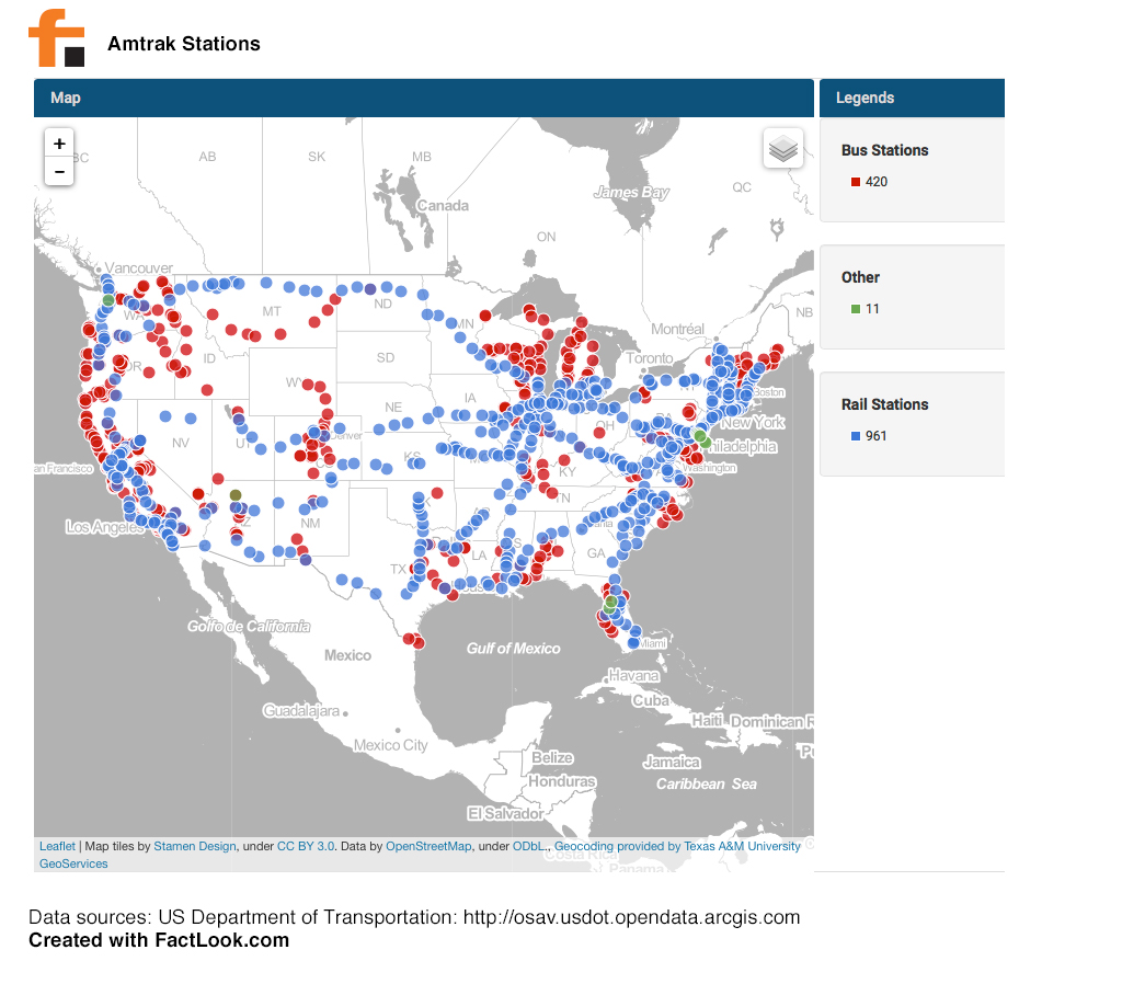
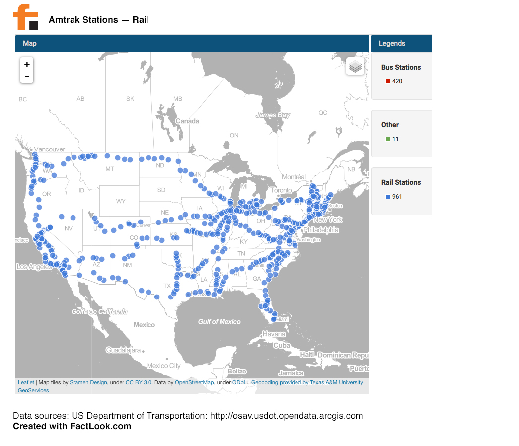
This visualization displays the location of Amtrak Stations across the United States. The Federal Railroad Administration’s (FRA) Amtrak Station database organizes this data by Bus, Rail and Other. We obtained the data from the US Department of Transportation Bureau of Transportation Statistics.
The data contained the latitude and longitude coordinates for each station, so we used FactLook‘s geocoding feature to plot each location, using the type (bus, rail or other) as a differentiator. This first screen shows all station locations across the US:
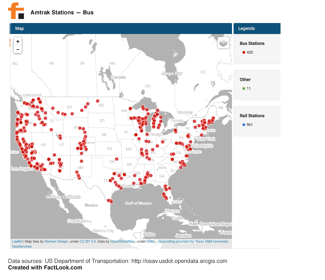
We then turned off individual layers to show only a single station type:

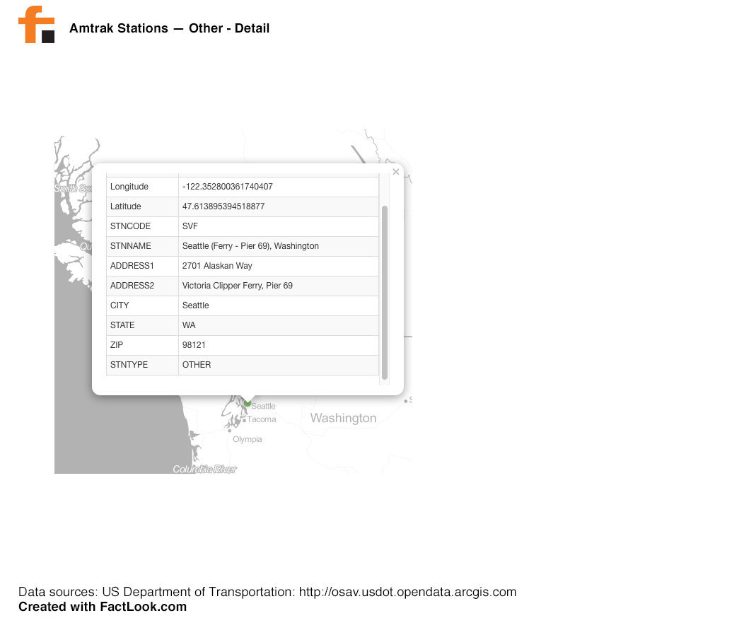
Clicking on a marker opens up a display showing details about that station. For example: